|
|
|
| Number of Peaks Climbed | 5 |
| Peaks Climbed | Macomb, South Dix, East Dix, Hough, and Dix |
| Peak Height Ranks | 6, 21, 23, 37, and 42 |
| Trailed / Trailess Peaks | 1 / 4 |
| Peak Numbers | 23, 24, 25, 26, and 27 |
| Total Elevation Gain | xxx feet |
Prologue:
Missing Blake in July had been a real disappointment to Kristy. Enough so that the second trip this year really wasn't an option. We finally worked out arrangements for the trip for September and were off to the High Peaks after working a half day. We arrived at our hotel near Schroon Lake late, as usual, and tried to get a good meal and to bed as early as we could.
07 September 2007
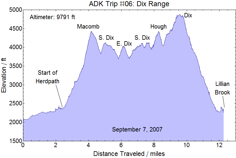
The Dix Range: We prepped our daypacks and loaded up our car and were off for the Elk Lake trail nice and early. It was still dark when we left the car, perhaps 0545, and we used our headlamps to hike in the dark before the light started picking up perhaps 15 minutes later. We made very good time down the Lake trail and were greeted by waking campers as we passed the Slide Brook lean-to. Heading up the herd path we quickly encountered blow-down. We picked our way through the debris hoping to find the herd path again and found ourselves searching for quite a bit longer than I was confortable with. Kristy checked the trail guide and there appeared to be no mention of this. So we started working from dead reckoning with the GPS as a tool, and after several false starts we began wending our way up the creek bed, my nervousness over lost time mounting as we searched. After retracing much of our progress we did find a clearly marked herd path and were please to be moving in the correct direction again. We'd guessed the wrong direction when we hit the creek bed and had found the herd path picking up on the other side of the creek perhaps a hundred yards above the point where the trail first hit the creek.
Excited to be in the trail again but frustrated over lost time on a day with a tight schedule I started pushing harder than I already had and before much more than another half mile up what turned out to be a much easier path to follow Kristy started telling me that she wasn't feeling well. Now, when Kristy tells me she isn't feeling well I ususally ignore it the first time because I'm a slow learner and also tend to be non-multitasking. When she tells me a second time I take notice. Kristy is a usually very healthy person and when she does start feeling poorly she usually keeps it to herself and suffers through it. When she bothers to tell me that means she's really not feeling great. So, I kept pushing, and Kristy eventually got nauseous enough to be sick. We had started up the true ascent of Macomb by this point so we decided we would at least try to get up Macomb before deciding what to do with the rest of the day. By the time we reached the slide Kristy was already feeling better. I had not a lot of fun on the slide. Loose rock and gravel undermining my footing while moving up perhaps 100 or more feet of open rock is a little scary for me. But I was very pleased to find the trail near the top left edge of the slide and get solid ground under my feet again. By now Kristy had started feeling much better and we were shortly on Macomb, shortly after 0900.
Money Shots: Macomb Mountain (23) - Summit 2007-09-07 10:05 EDT

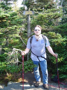
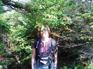
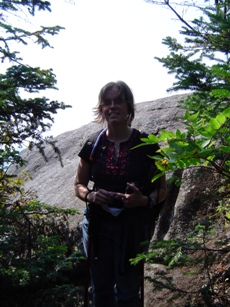
Since Kristy was feeling much better we decided to push on. the climb down from Macomb to the col was a deeper descent that I wanted to see, but we finally hot the col and were heading up to South Dix hitting the summit much more quickly that I had expected. We hit the peak at about 1100, or perhaps 1115. We sort of thought the first summit was the false summit and we found a rock we later thought was the true summit, but reviewing the GPS logs seems to suggest the first summit was the true summit. The images assume that's true.
Money Shots: South Dix (24) - Summit 2007-09-07 11:00 EDT

False Summit 2009-09-07 11:15 EDT
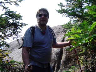
Pushing on we started noticing the close pines. The herd path remained quite easy to follow, but the short pines, three to four feet tall, grew so close that in many if not most points the trail wasn't directly visible and the pines were always pressing against us from both sides. This was never an impediment to travel, but early on we were wet from the dew on the pines and later we found that we were continuously getting needles onto our clothing, which could be a little uncomfortable at times. My nervousness about how much daylight we were burning was not getting better, either. We had looked for the spur off toward Hough and Dix that we expected to see on the way to South Dix but had missed that. This only added to our unease regarding the uncertainty of the trail ahead. Despite the close pines the trip across the ridge to East Dix was easy and fast. We were on East Dix at about 1230 and we stopped for some food and rest before heading back to South Dix.
Money Shots: East Dix (25) - Summit 2009-09-07 12:30 EDT
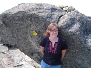

So back to South Dix we headed and about half way back we ran into a group of three men working the same route as us. They had hiked Dix via the Dix loop the day before and were now planning to push out to East Dix, double back for the spur out to Hough, then return back to their tents at Slide Brook via Lillian Brook. We thought that was the last we'd see of them. We continued on to South Dix and with a little searching found the trail off the Hough. It was probably after 1400 when we set off for Hough and my nervousness conitnued to grow. Kristy wanted to push on to Dix so that we wouldn't gather yet one more orphan, but I was pretty adamant that we'd only get Hough and that we'd then call it a trip and get as far out toward the car as we could before it got dark. I absolutely didn't want to be caught on any peaks (or worse in between peaks) when the sun went down. But we pushed ahead and we reached Hough at about 1550, with the sun starting to look ominously low.
Money Shots: Hough Peak (26) - Summit 2009-09-07 08:30 EDT


Down the Lillian Brook Trail: Sadly, we were so busy worrying about the emptying of the hourglass that we blew right past Hough as soon as we reached the peak and never stopped to take pictures. This were our only missed peak images in the Adirondacks so far, and we hope we don't miss any more! But this wasn't the only mistake. My imperfect memory of the trail we'd planned meant that it was about ten minutes after pushing off of Hough towards Dix before I started commenting that I'd expected to see the turn off for the Lillian Brook Trail by now and was concerned we might have missed it. The Kristy explained to me that I was mistaken and that the Lillian Brook Trail was before Hough, but that she hadn't seen it before we reached Hough - and repeated her already voiced concern that there might still be significant blow-down on the Lillian Brook Trail and that we might not be able to navigate it in the dark. So, with little good options and having already started up out of the col between Hough and Dix we decided it made the most sense to just push forward and at least have the advantage of the well-establish and marked Dix Trail to negotiate when the sun actually fell.
An end of Dix: Ahead we pushed. My reserves were quite low at this point and actually had to stop for about two minutes out of twenty for most of the final ascent of Dix. And when we got to the open ridge of Dix I predictably had to deal with my fear of heights and so was moving a bit slowly. But we finally reached the summit at about 1805, perhaps an hour and a half before nightfall.
Money Shots: Dix Mountain (27) - Summit 2009-09-07 18:05 EDT
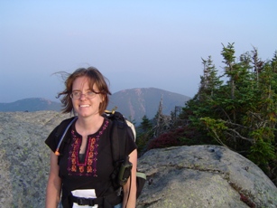

Leaving Dix: 2009-09-07 18:30 EDT
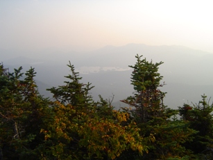
A long day's journey into night: The initial descent of Dix was slow and difficult because of open rock climbs and at one point had to squeeze between boulders that weren't much wider than I was. Thankfully, we pushed through that before I even realized how close I had come to getting stuck. But we finally hit a more sheltered path and started moving a little quicker. Unfortunately, we got little better than a half hour or so of decent light to make our way down before it got dark. So into the dark and down the mountain we hiked. And do I mean down. I'm sure the fact that we could only see what was immediately in front of us with our headlamps made it seem all that much further and that much steeper, but it was definitely a long march and it was definitely steep. Down and down we went, and Kristy remarked more than once that she was only worried that we wouldn't miss the main trail and that when we finally got to the main trail near Dix pond it would be much flatter and much easier and we would eventually find water. Did I mention we'd found no water on the trail and that we ran out shortly before reaching the summit of Dix?
Down the rocks we went, with plenty of water dripping between the rocks, but never a puddle large enough to filter for our packs. Imagine our relief when we reached the main trail and turned left toward Lillian Brook. I was dog tired at this point. It must have been near 2300 when, perhaps half a mile from the trail junction and before we were able to reach Lillian Brook when decided I simply wasn't moving on. I knew there was no way we were going to walk all the way to the car, I no longer had a clear idea of how far we had come and how much further we had to go, and it was quite warm enough for me to be comfortable where we were. Kristy urged us to continue forward at least as far as Lillian Brook for the lean-to, but I was unwilling to put in the extra effort and wasn't sure we wouldn't find a fully occupied lean-to anyways. So I found a nice comfortable looking patch along the side of the trail, propped my head up on my pack, and tried to sleep. Kristy grudgingly followed my lead and I think I probably got a good half hour of sleep in over the next hour before we started thinking that we were hearing voices. We had heard voices voices intermittently as we were descending Dix, but though we called out at several points we were never answered. So we waited, and eventually there was no doubt we were hearing voices. Finally, the group we had met between East Dix and South Dix came slowly out of the darkness and I think they were actually more glad to see us than we were to see them.
A dry journey: We shared events of the day and found out that of the three one of the men was in a bit of distress and that all were desperately thirsty. We had been without water since the Dix ridge and were thirsty, but they had been drinking water treated with iodine for the past two days and had been without even that for most of the afternoon and evening. They had actually used the caps from they water bottles to collect water in the shallow muddy puddles in between the rocks on the descent of Dix and poored double doses of iodine into the muddy water they'd gathered in an attempt to satisfy their thirsts. No wonder they were in distress! We encouraged them forward and promised that at Lillian Brook we would all drink fresh water. They moved, but only slowly and we had to stop at several points. According to our GPS log we had stopped perhaps a quarter of a mile from Lilian Brook but it probably took us over half an hour and encouragement to get them to Lillian Brook. But once there we pumped them a bottle of fresh, cold water and everyone responded well to the first fresh drink they'd had in days. Sadly, despite my urgings, we were unable to convince them to dump out the muddy iodine water they'd painstakingly gathered on Dix and replace it with fresh water. They felt it would be asking to much for us to pump that much water. So we filled our bladders and pushed off down the Dix Trail toward the campsites at Slide Brook where there tents were and where the last leg of our trail back to Elk Lake Road led to our car.
And the night skies open up: We probably started out around 0100 and didn't arrive at Slide Brook until after 0200. It was a a long slog full of many stops and many necessary encouragements to keep one of them moving. But we finally stepped into the clearing with the Slide Brook lean-to only to find it occupied and laid down in the clearing across the path from the lean-to while the other continued on to their tents. I was just laying on the ground. Kristy had decided she was getting more comfortable and had pulled off her hiking boots and really bedded down. It couldn't have been five minutes after arriving that there was one ominous clap of thunder and moments later the skies opened up. I yelled, "let's go." and ran for the lean-to to force my way onto the end out of the rain. I had no idea why Kristy just seemed to sit in the clearing and wouldn't come while the rain pounded down on her, but after a couple of minutes she finally jumped up and ran to the lean-to where she sat looking at me as I settled back down with my pack under my head. She eventually asked when we were leaving. I don't think I actually said anything and she somehow read the expression on my face in the dark. She had thought I was taking off to make a dash for the car in the rain and had therefore sat lacing up her boots while being drenched to prepare for the hike. She now understood I had no intention of making for the car and attempted to make herself comfortable lying dripping wet on the hard (but dry) wood of the lean-to. When the sky lightened enough for me to be sure it was nearing sunrise I rousted Kristy and we limped on down the trail toward our car. Once there we drove back to our hotel and asked if he had a room for us. He was a little unaccustomed to renting our rooms at 0700, but remember us from earlier and gave us a room. He was even more surprised when we handed his key back and thanked him less than an hour later after we'd gotten hot showers and had changed into clean clothing. We stopped in Schroon Lake for breakfast and spent a long tired say driving home.
Night on the trail: We learned a lot that night. We learned that being caught on the trail after dark wasn't as scary as we thought it would be. We learned that we have resouces we didn't know we had and that we can do what we need to do to finish the 46. I was so frustrated when we were delayed early on in the day, but if we hadn't been delayed we would have pushed on to Hough before the other hikers got to South Dix. I was even more frustrated when we missed the Lillian Brook trail, but when the other group missed the same trail we were where they needed us when they came down the trail. In a perfect world I wished we'd pushed on just farther enough to sleep in the lean-to at Lillian Brook, but I don't know the other group would have made it as far as Lillian Brook had we not been on the trail to meet them and urge them on. And if they had come down to Lillian Brook I don't know that we would have left the lean-to to talk to them and doubt they'd have made it back to their tents before the dowpour came. Nor would we have been near the lean-to at Slide Brook. The events of that day happened for a reason and we were on that trail waiting for those hikers to come by when they needed us - and when we needed them.
Next trip: Last trip pf the year. Plans to be made.
Child stats: Rachel - t minus 8 months and counting!