|
|
|
| Number of Peaks Climbed | 3 |
| Peaks Climbed | Marcy, Gray, and Skylight |
| Peak Height Ranks | 1, 4, and 7 |
| Trailed / Trailess Peaks | 1 / 2 |
| Peak Numbers | 13, 14, and 15 |
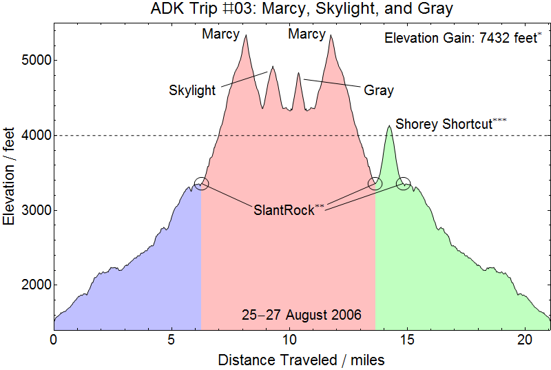
| Total Elevation Gain | 7356 feet (6259 feet) |
Prologue:
2005 had been a busy year that included us becoming homeowners, reversing our commute, and Kristy writing up and defending her PhD dissertation. In 2004 I was working in Arlington and had an apartment in Northern Virginia while Kristy remained down in our apartment in Charlottesville working on her studies as the University of Virginia. I would drive up at o-dark-thirty every Monday morning, work through the week, and drive back down to Charlottesville Friday afternoon. This got old, but it meant that Kristy had lots of free time on her hands to devote to her studies. With Kristy still studying and having to maintain two apartments I of course found the most inexpensive apartment I could. It was really kind of a dive. I tried my best to fix it up and clean it up as best as I could, but it had roaches and major plumbing problems, and by the end of the year I was actually evicted because the property was condemned and we were forced to either find another (and proably more expensive) apartment or by a house. Since apartment rates were in fact as high or higher than mortgage payments we really only had one choice. This also meant we really had to give up our apartment in Charlottesville. So we moved up to Northern Virginia and Kristy did the opposite commute I had done living (well, actually just bunking) with a friend in Charlottesville during the week. That also got old fast, but while it did result in us taking a year off from hiking it did incentivize Kristy to wrap up her studies!
24 August 2006
Garden to Slant Rock: After a good year off from hiking we were itching for a challenging hike. What could be more challenging than Marcy? (Well, in fact we would later find the answer to that question, but for now Marcy sounded like a lot of work and a lot of fun). We'd lightened up our load a little with the lighter sleeping bags we'd acquired for hiking during warmer parts of the year and our ever improving sense for what to take, and more importantly what not to take, on a hiking trip. We set out on 24 August after work and to the northern outskirts of New York City, stopping at a hotel near where I-287 meets the Dewey Thruway heading North to Albany. It had been my hope to hit this point by mid-evening, but with horrible traffic and other unpleasantries we ended up pulling into the hotel at probably about 2300. With few other options left we ordered pizza for delivery at the hotel and tried to sleep for the trip ahead.
25 August 2006
To the Garden: The morning started out a little later than I might have hoped, searching in vain for the light breakfast promised when we checked into the hotel, but we finally got on the road and had an otherwise uneventful trip up to the Garden. With out gear strapped on we set off for John's Brook Lodge en route to Slant Rock. The trip in to the Lodge was easy and uneventful as always.
On to Slant Rock: It's actually difficult to remember if we stopped at all at John's Brook Lodge. I suspect not. But on up the Phelps Trail we went. Even with our lighter packs the seven mile trip in the Slant Rock over Hogback and up to the higher ground is still a good workout. But after about three hours or so we were there and looking for a good camp ground to establish our base camp. About half a mile out from Slant Rock we joined a pair of DEC folks heading out from a tour of duty and talked about our planned adventures. When we told them that among our goals were Basin and Saddleback they became very concerned that we might attempt Basin with full packs. We assured them that we had no intention of carrying our full packs over any peaks, but they remained concerned regarding our hiking plans nonetheless. But arriving at Slant Rock with plenty of time before dark we were able to fill our water bladders at the stream, enjoy a nice hot meal, and clean up before bedding down for the night.
26 August 2006
Back on the trail again: The probably hit the trail at 0600, just a little before sunrise, with an ambitious (but not overly so) day of hiking planned. The trail to Marcy becomes noticeably steeper than the trail in to Slant Rock almost immediately. The trail up Marcy was, as is no surprise, relentlessly steep, though it was never as consistently steep as the ascent of Algonquin from Marcy Dam, nor was the distance to Marcy's peak from Slant Rock as great as the distance from Marcy Dam to Algonquin. It didn't hurt that is was dry and relatively warm, either! So the ascent of Marcy was really a lot of fun. Along the way we eventually came to the end of significant tree cover and reached the more open slopes of the mountain.
Our first open views of the climb ahead of us...
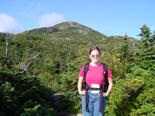
Marcy peak in our sights, up we went. Distances can be deceiving. It was probably a good mile before we finally reached the peak. The ascent was relatively uneventful, which is a good thing, but thoroughly enjoyable. My fear of heights notwithstanding, there were some nervous moments, but up we went. Within about a quarter mile of the peak we were overtaken by a family with small children (that's always encouraging!) that continued on to the summit. The approximately seven year old girl with her back pack that carried her stuffed animal. We arrived at the peak shortly after them, a little after 0830, and so were the second party to summit Marcy that morning. We spent some time on the peak enjoying our accomplishment, the beautiful weather and views, and to share trail stories with the other party on the peak.
Money Shots: Mount Marcy (13) - Summit 2006-08-26 08:35 EDT
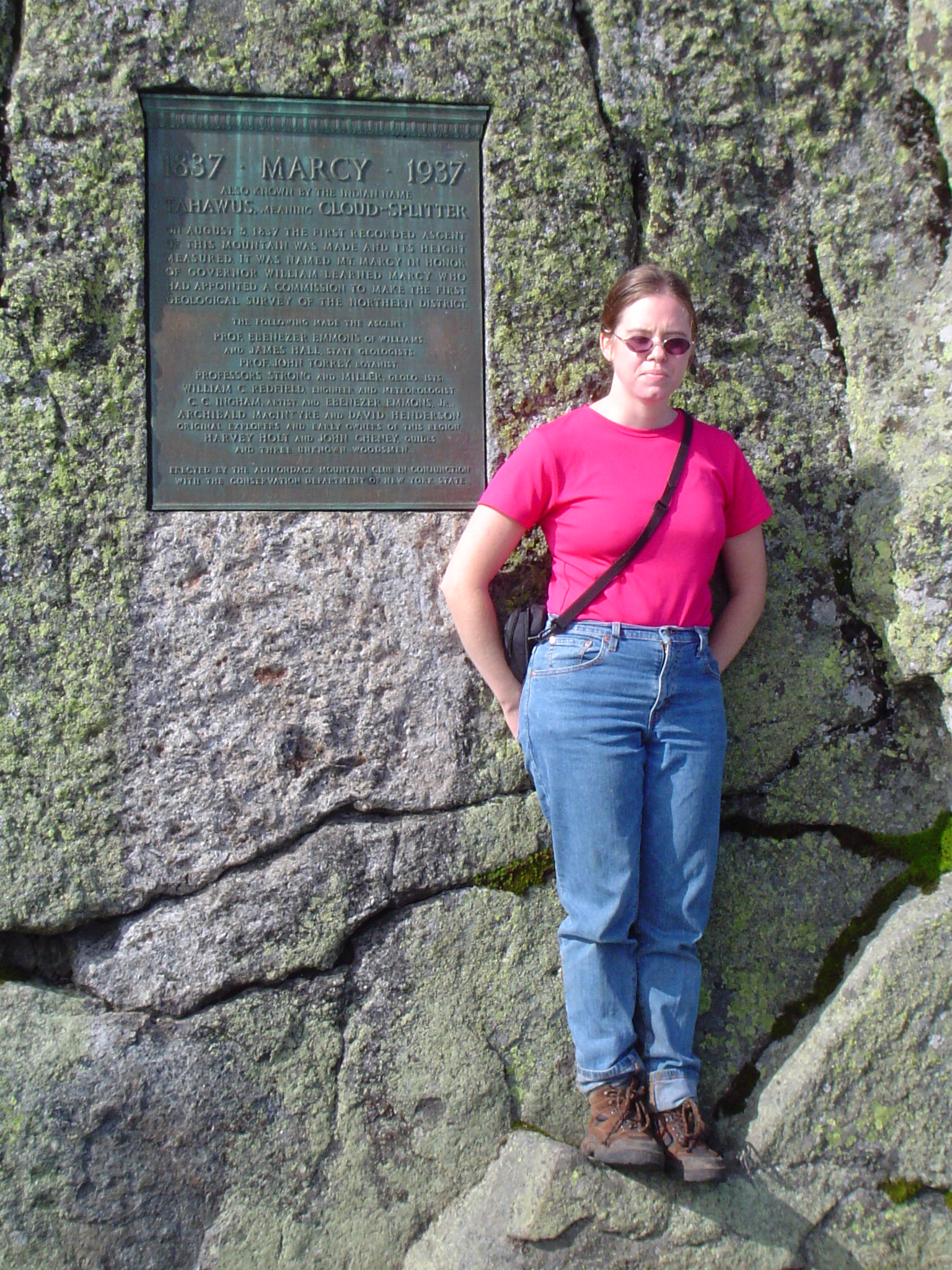
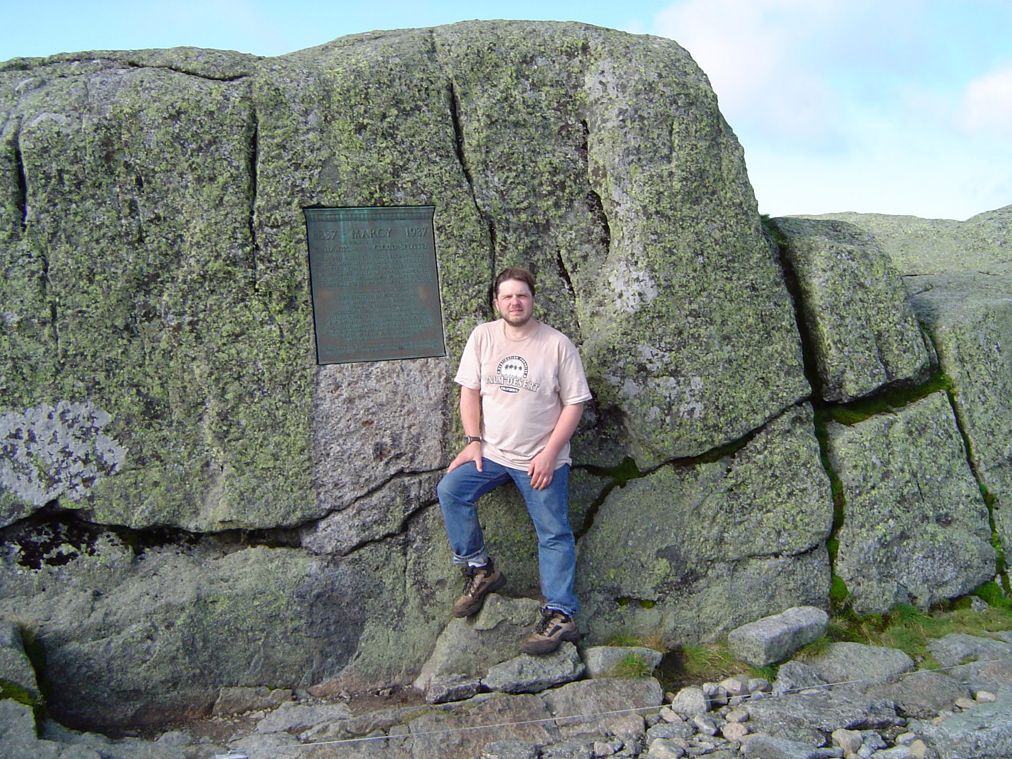
Marcy! The Big Kahuna! And 33 peaks to go...
Mount Skylight and clouds: After surveying the views we pushed over the peak to Schofield Cobble and down to the Four Corners. Down. Down. And every step of the way knowing we were going to have to reclaim all of those steps down to return to camp. From Four Corners we pushed up to Skylight. Kristy thought to bring a rock with her to place on one of the cairns. I forgot. So I blame myself for the weather that followed. It grew progressively more cloudy as we summitted Skylight and we reached the peak at about 1010.
Money Shots: Mount Skylight (14) - Summit 2006-08-26 10:10 EDT


After a little refreshment on Skylight we headed back down to Four Corners. From Four Corners we headed off to Tear of the Clouds for the herd path to Gray Peak. We stopped at Tear of the Clouds to pump water and enjoy the scenery, reflecting on Teddy Roosevelt's time there in 1901 after summiting Marcy, where he learned that McKinley's condition had worsened. Concerned about time, I decided we would stop for pictures at Tear of the Clouds on the way back. Our initial plan had been to push over Gray Peak for the shorter trip back to Marcy, but the family we visited on Marcy advised strongly against that route, stating that the bushwhack was difficult enough that the trip back down the herd path to Four Corners was far easier. So up we went. Our second herd path, we were pleased that we spent little if any time searching for the way forward. There were some rogh scrambles along the way, but nothing too difficult. We pushed up to the peak and arrived at about 1230.
Money Shots: Gray Peak (15) - Summit 2006-08-26 12:30 EDT
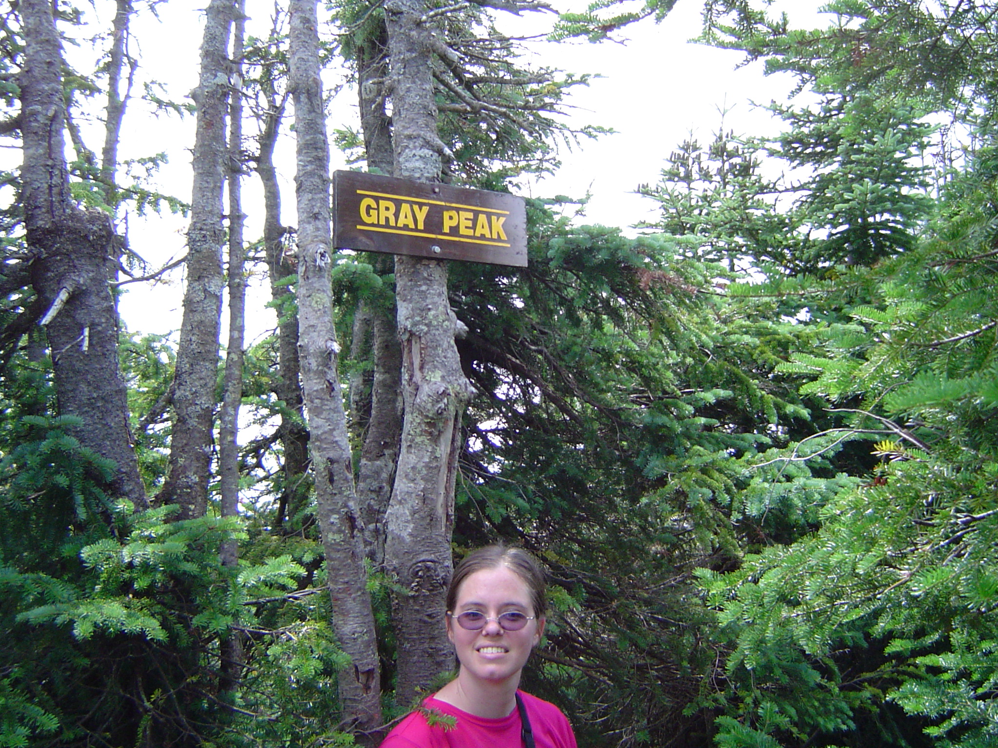

We pushed just far enough over the peak to convince ourselves that the bushwhack would be substantial and turned to head back down to Tear of the Clouds. At just that moment a group of hikers came up and asked if we had located the bushwhack. We told them what we had heard and what we had seen and that we had decided to turn back. They were skeptical and said they were pushing forward. So on they went and down we went. We reached Tear of the Clouds with an ever thickening cloud deck above us and I urged as rapid a pace as I could muster, forgetting that I had planned to stop for pictures on the way back to Marcy. Oops!
Marcy and camp: So down we went - and UP we went. Over 1000 feet from the Four Corners and we definitely felt the work. We got to the peak and asked hikers there about the party we had crossed on Gray. Apparently they had reached Marcy before us and pushed on toward camp. Oh well. Though there didn't appear to be any imminent threat of rain the weather had steadily deteriorated during the afternoon and it appeared as though there was no chance that conditions would improve any time soon. So, after some rest on our final peak of the day, the second ascent of Marcy, we moved on for a well deserved trail end and rest for our planned hike the following day. Shortly after leaving the peak we were passed by a young and athletic group we had met in camp the night before. They bounded down the rocks as I picked my way down slowly and methodically, my views of the heights informing my fear of heights after spending significant amounts of the day on open rock. That pace stayed somewhat slow the rest of the way, with a claim upon rejoining our campmates obviously well after they returned that we had proudly recorded the slowest descent of Marcy. But with plenty of time left before nightfall we joined them in a clearing to boil water for our Easy Mac before cleaning up and bedding down for an easy sleep. Our relative remoteness, the presence of other campers, and the advent of stricter bear canister rules in the Adirondacks greatly calming Kristy's worries sleeping in camp. We slept quite well, but we did wake occasionally to hear the quite impressive rain outside our tent, hoping that the evening rain would give way to clear skies and a sunny morning to dry off the peaks.
27 August 2006
The sun did not shine, it was too wet to play: It was not raining when we woke in the morning. We hoped that the front might be passing, and after slogging through camp (we had found high ground, but others who came after us were in much wetter campsites) we prepared our packs and headed up the Shorey Shortcut for an advance on Basin and Saddleback, with hopes for Haystack if we had made good progress so far. We made good time up the somewhat steep but relatively well conditioned trail (it was easy to walk on the rocks!) and had probably made the better part of half a mile in the twenty minutes or so we hiked up the trail. It had started raining almost immediately after we started up. Light at first. But after about five minutes it had picked up a little more. The last five minutes up the Shorey Shortcut the rain became pretty steady, and I hated to do it but I called the hike - especially sad after getting off to such a good start. The rain actually picked up even more after we turned around, confirming that we had made the right decision, but mercifully backed off as we arrived back in camp. Our site was above water, but we passed many folks bailing there tents out of the pddles they found themselves in. We still had the unenviable task of packing up our site soaking wet and with a light rain still falling. Much of this task fell to Kristy who knew better than I where everything had to go fit in our packs. But muddier and wetter we were both ready to move in about twenty minutes.
Over the river and through the woods: So down the Phelps trail we went, thankful for the tree cover which kept most of the rain off us. The early part of the trail was relatively firm ground with a lot of rock that meant the trail was sure. Over Hogback we went and then we started moving into the lower ground with less rock and more - MUD! Adirondack Boot Sucking(TM) Mud to be precise. At one point, perhaps a mile out of John's Brook Lodge, Kristy went knee deep in a particularly hungry patch and graciously surrendered her boot to the mud. I feel bad for laughing the way I did as she attempted to free herself. But she got free, retrieved her boot, and on we went. We collapsed briefly at the Lodge before pushing on - and noticing that the rain had ended and that the sky had begun to clear. But on we pushed, over the river, out to the Garden over the much more polished trail East of the Lodge, and retrieved our car to find a hostel. Cleaned up and dry we found had an absolutely amazing hot lunch at the Noon Mark Diner (oddly appropriate) and headed off for or long drive home.
Next trip: With only three peaks on the trip we considered it a not teribly productive trip, but we don't consider our missed opportunity on the rain day to have added any orphans to our list. But we definitely didn't remove Saddleback from our orphan list as we'd hoped. We had no particularly plans for the next trip, but after such a long hiatus from the High Peaks and a relatively unproductive trip we were eager to return quickly.